The Great Barrier Reef Marine Park Authority acknowledges the expertise, wisdom, and enduring connections that have informed the guardianship of the Reef for millennia. We pay our respects to the Traditional Owners as the first managers of this land and sea, and value their traditional knowledge which continues to inform the current management and stewardship of the Reef for future generations.
Search

Tropical Cyclone Projections Portal
The National Environment Science Program (NESP) Tropical Cyclone Projections Portal provides information on the historical and projected future frequency of tropical cyclones (TC).
Deepreef Explorer
Deepreef Explorer is the website for Dr Robin Beaman and the scientists working to reveal the underwater landscape and seabed habitats of Australia’s regional seas.
Allen Coral Atlas
The Allen Coral Atlas maps and monitors the world’s coral reefs to provide actionable data and a shared understanding of coastal ecosystems.
Australian Heritage Database
The Department of Climate Change, Energy, the Environment and Water’s Australian Heritage Database contains information about more than 20,000 natural, historic and Indigenous places.

Reef 2050 Integrated Monitoring and Reporting Program
Learn more about the Reef 2050 Integrated Monitoring and Reporting Program (RIMReP).
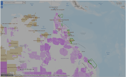
Land and Sea Country map
The Land and Sea Country map has the option to display multiple data layers relevant to Aboriginal and Torres Strait Islander peoples.
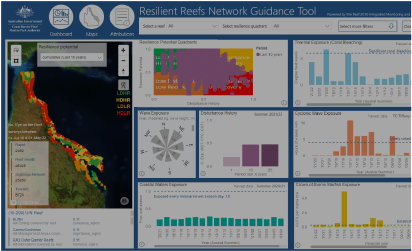
Resilient Reefs Network Guidance Tool
The Resilient Reefs Network (RRN) guidance tool is a dashboard that will support your investigation of environmental pressures affecting areas across the Great Barrier Reef.

Digital Earth Australia Coastlines
Geoscience Australia's Digital Earth Australia program combines satellite data with tidal modelling to map the typical location of the coastline at mean sea level for each year.