The Great Barrier Reef Marine Park Authority acknowledges the expertise, wisdom, and enduring connections that have informed the guardianship of the Reef for millennia. We pay our respects to the Traditional Owners as the first managers of this land and sea, and value their traditional knowledge which continues to inform the current management and stewardship of the Reef for future generations.
Search
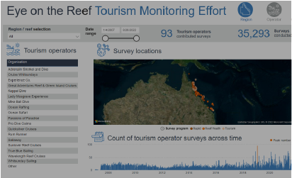
Tourism Monitoring Effort
The Tourism Effort dashboard showcases the important effort tourism operators contribute to the Eye on the Reef Program.

Reef monitoring dashboard
The Australian Institute of Marine Science (AIMS) Reef monitoring dashboard provides information on the status and trends from survey data for individual reefs and regional summaries.

Ocean Temperature Outlooks
The Bureau of Meteorology (BOM) Ocean Temperature Outlooks pages provide seasonal sea surface temperature forecasts for regions around Australia.
Sea temperatures and Currents
The Bureau of Meteorology (BOM) Sea temperatures and Currents map provides ocean forecasts across Australia.

Australian Baseline Sea Level Monitoring Project
The Bureau of Meteorology (BOM) Australian Baseline Sea Level Monitoring Project provides monthly data reports.
eReefs Modelling & Information System
The eReefs Modelling & Information System allows users to search for and visualise available data across multiple components of the eReefs marine models.

Queensland Wetland Maps
The Queensland Government’s WetlandMaps provides an interactive map service that gives users fast and easy access to wetland information.
MetEye
The Bureau of Meteorology (BOM) online MetEye tool helps you visualise local weather observations and forecasts for any location in Australia.

Windy
Windy is a professional weather app, created for water and wind sports: sailing, surfing, fishing, and etc. Get detailed weather forecast, live world wind map, and local weather reports.

eAtlas map
The eAtlas is a website and mapping system for presenting environmental research data in an accessible form that promotes greater use of this information.

Map of coastal weather observations
The Bureau of Meteorology (BOM) Map of Coastal Weather Observations use locations identify stations where the weather observation data is collected.

Tide Predictions
The Bureau of Meteorology (BOM) Tide Predictions map provides predictions across Australia, the South Pacific and Antarctica.